|
|
|||||||||||||
|
|||||||||||||||
|
|
|
Global urban high-resolution land-use mapping: From benchmarks to multi-megacity applications |
||||
|
|
||||
|
Abstract
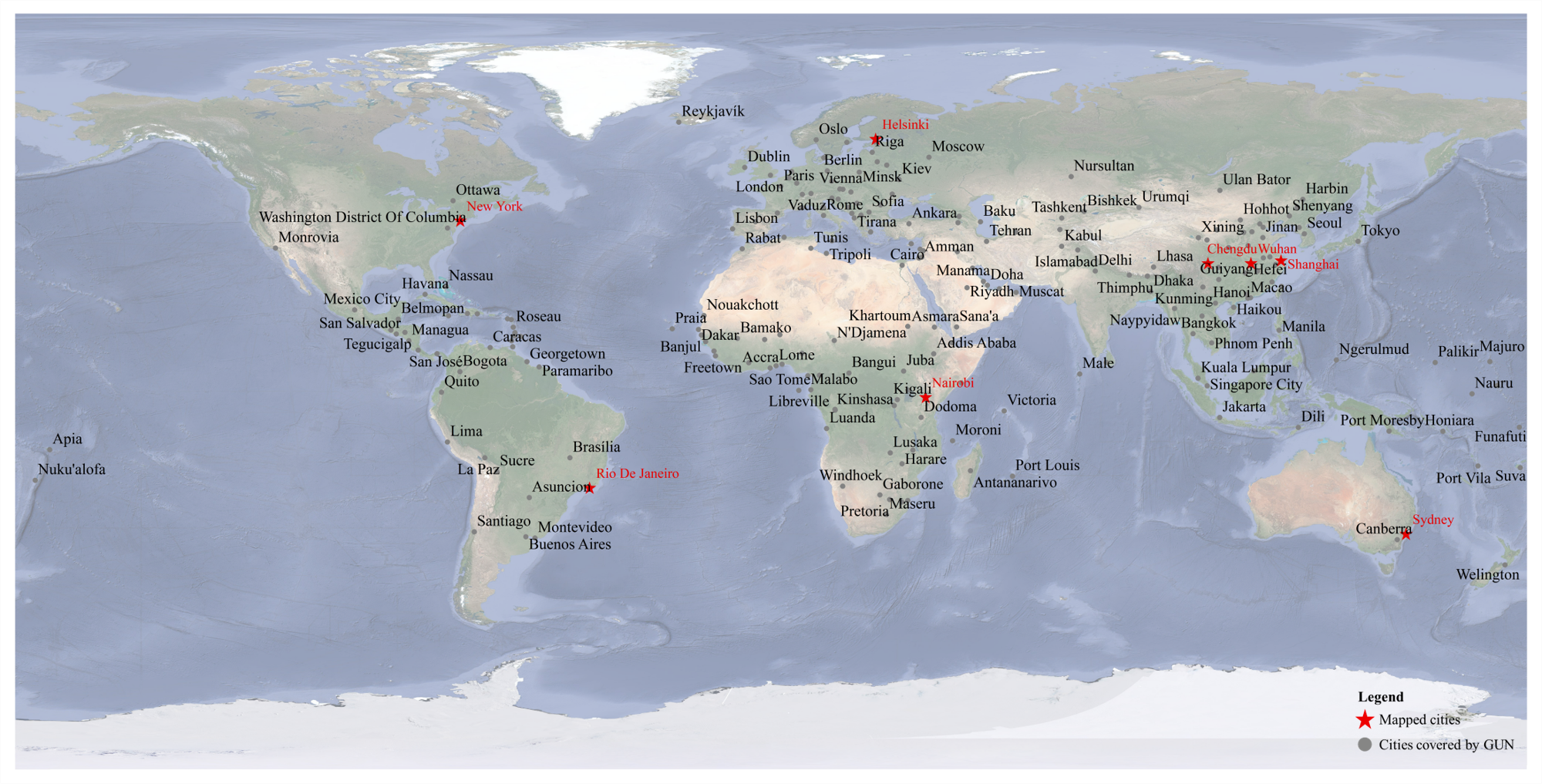
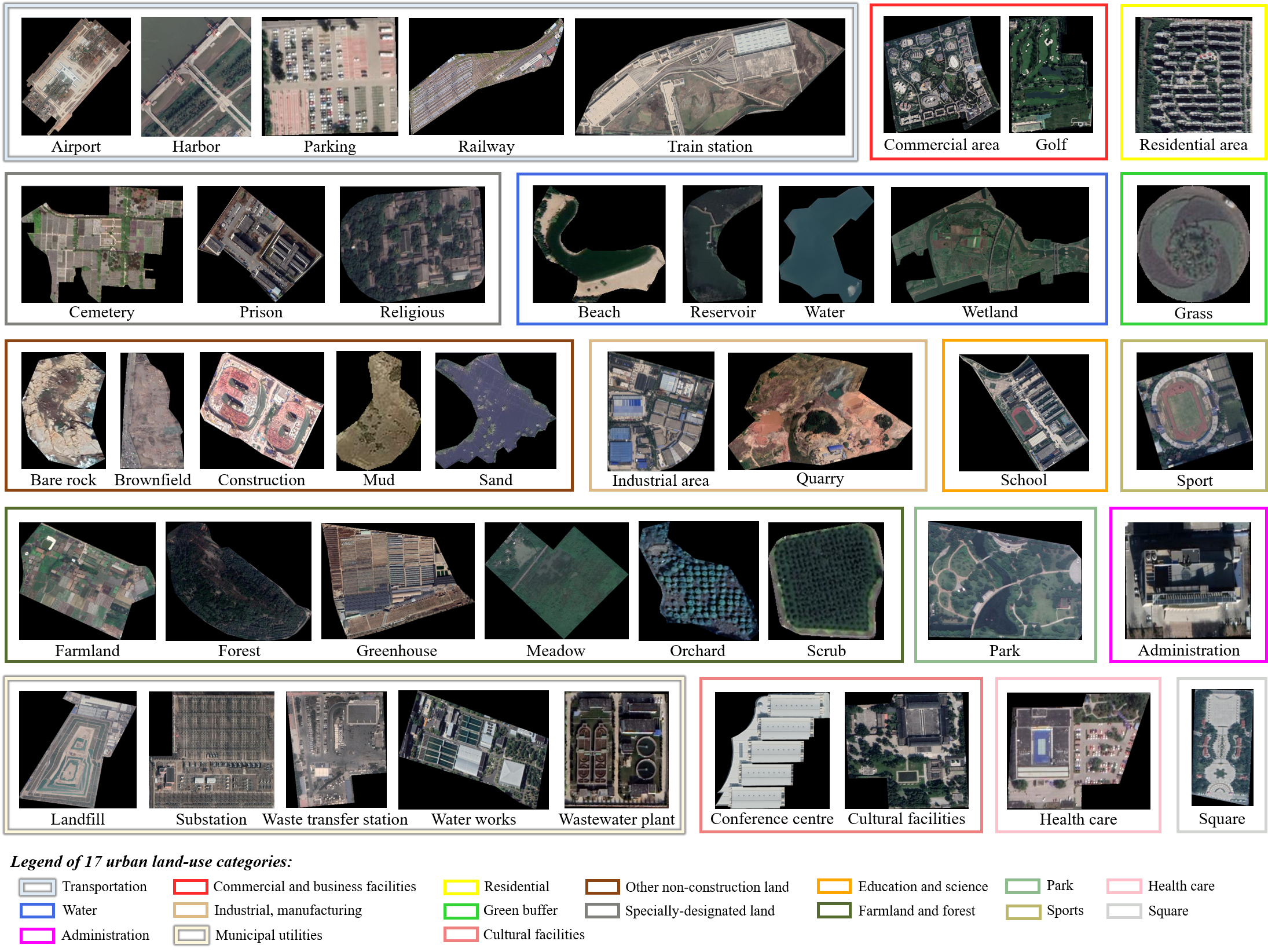
The GlobalUrbanNet (GUN) dataset is a global high-resolution urban scene dataset containing 42 fine-grained categories, designed to support urban land-use mapping and analysis. This dataset was constructed using VHR remote sensing image and area-of-interest (AOI) data from OpenStreetMap (OSM), acquired in 2021. The GUN dataset consists of 1,846,151 samples, covering 227 cities, including 193 member states of the United Nations and 34 provincial cities in China. With a total area of 1591,693.82km2. This dataset features sub-meter resolution, a scale of millions of samples, and terabyte-level data volume, making it well-suited for research on high-resolution urban land-use mapping. 1. The GUN dataset The spatial resolution of images in the GUN dataset is 0.5m, obtained from open-source websites or purchased. Since the scenes delineated by AOIs are irregular, the size of each scene image varies. The sample distribution of the GUN dataset and the samples for each category are shown in Fig. 1 and Fig. 2, respectively.
2. Download We hope that the release of the GUN dataset will promote the development of global urban land-use mapping. You can click the link below to download the data: ● Baidu Netdisk: download ● Google Drive: download 3. Evaluation Server If you want to get the test scores, please join our hosted benchmark platform: global urban scene classification 4. Copyright The copyright belongs to Intelligent Data Extraction, Analysis and Applications of Remote Sensing(RSIDEA) academic research group, State Key Laboratory of Information Engineering in Surveying, Mapping, and Remote Sensing (LIESMARS), Wuhan University, China. The GUN dataset only can be used for academic purposes and need to cite the following paper, but any commercial use is prohibited. Any form of secondary development, including annotation work, is strictly prohibited for this dataset. Otherwise, RSIDEA of Wuhan University reserves the right to pursue legal responsibility. Zhong Y, Yan B, Yi J, et al. Global urban high-resolution land-use mapping: From benchmarks to multi-megacity applications[J]. Remote Sensing of Environment, 2023, 298: 113758. 5. Contact If you have any the problem or feedback in using the GUN dataset, please contact: Miss. Ruiyi Yang: ruiyi_yang@whu.edu.cn Prof. Yanfei Zhong: zhongyanfei@whu.edu.cn |
|