|
|
|||||||||||||
|
|||||||||||||||
|
|
|
Global road extraction using a pseudo-label guided framework:
From benchmark dataset to cross-region semi-supervised learning |
||||
|
|
||||
|
Abstract
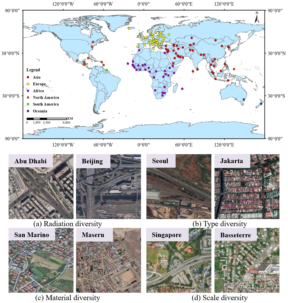
Recent advancements in satellite remote sensing technology and computer vision have enabled rapid extraction of road networks from massive, Very High-Resolution (VHR) satellite imagery. However, current road extraction methods face the following limitations: 1) Insufficient availability of accurate and diverse training datasets for global-scale road extraction; 2) Costly and time-consuming manual labeling of millions of road samples; and 3) Limited generalization ability of deep learning models across diverse global contexts, resulting in better performance for regions well-represented in the training dataset, but worse performance when faced with domain gaps. To address these challenges, a global-scale benchmark dataset termed GlobalRoadSet (GRSet) was developed. 1.The GRSet dataset The GRSet dataset contains 47,210 samples (1024 × 1024) from 121 capital cities across six continents in Europe, Africa, Asia, South America, Oceania, and North America, with a total area of 49,503 km2. An overview of this dataset is provided in Fig. 1.
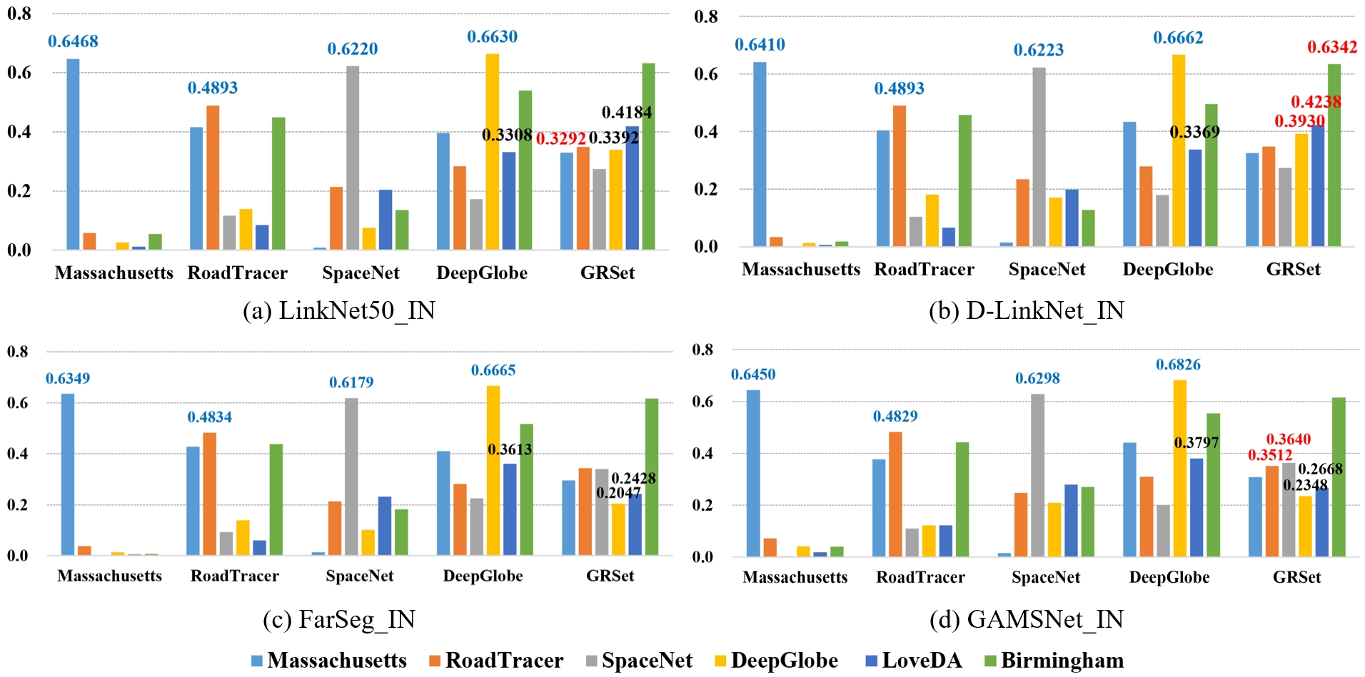
2.Experiment Fig. 2 presents quantitative IOU comparisons among the five road datasets. Blue numbers indicate test results obtained when the training and test sets were sourced from the same dataset, while red numbers indicate the optimal test results achieved when training models on GRSet.
3.Download We hope that the release of the GRSet dataset will promote the development of global-scale road extraction. You can click the link below to download the data: ● Baidu Drive: download ● Github: website 4.Copyright The copyright belongs to Intelligent Data Extraction, Analysis and Applications of Remote Sensing(RSIDEA) academic research group, State Key Laboratory of Information Engineering in Surveying, Mapping, and Remote Sensing (LIESMARS), Wuhan University, China. The GRSet dataset only can be used for academic purposes and need to cite the following paper, but any commercial use is prohibited. Any form of secondary development, including annotation work, is strictly prohibited for this dataset. Otherwise, RSIDEA of Wuhan University reserves the right to pursue legal responsibility. Xiaoyan Lu, Yanfei Zhong, Zhuo Zheng, Junjue Wang, Dingyuan Chen, and Yu Su. Global road extraction using a pseudo-label guided framework: from benchmark dataset to cross-region semi-supervised learning. Geo-spatial Information Science [J], pp. 1-19, 2024. 5.Contact If you have any the problem or feedback in using GRSet dataset, please contact: Dr. Xiaoyan Lu: luxiaoyan@whu.edu.cn Prof. Yanfei Zhong: zhongyanfei@whu.edu.cn |
|