HyperFree

A Channel-adaptive and Tuning-free Foundation Model for Hyperspectral Remote Sensing Imagery (CVPR 2025)

HyperFree is a hyperspectral foundation model with the abilities of channel adaptive and fine-tuning free, which is suitable for hyperspectral classification(HC), hyperspectral one-class classification(HOCC), hyperspectral anomaly detection(HAD), hyperspectral target detection(HTD) and hyperspectral change detection(HCD) tasks. With further tuning, HyperFree can also be adapted to spectral unmixing, object tracking and image denosing tasks.

Motivation

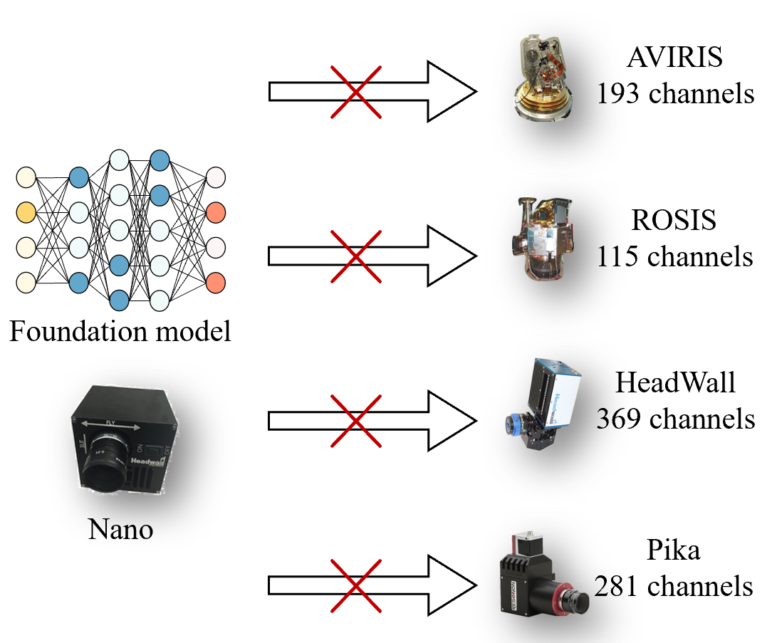
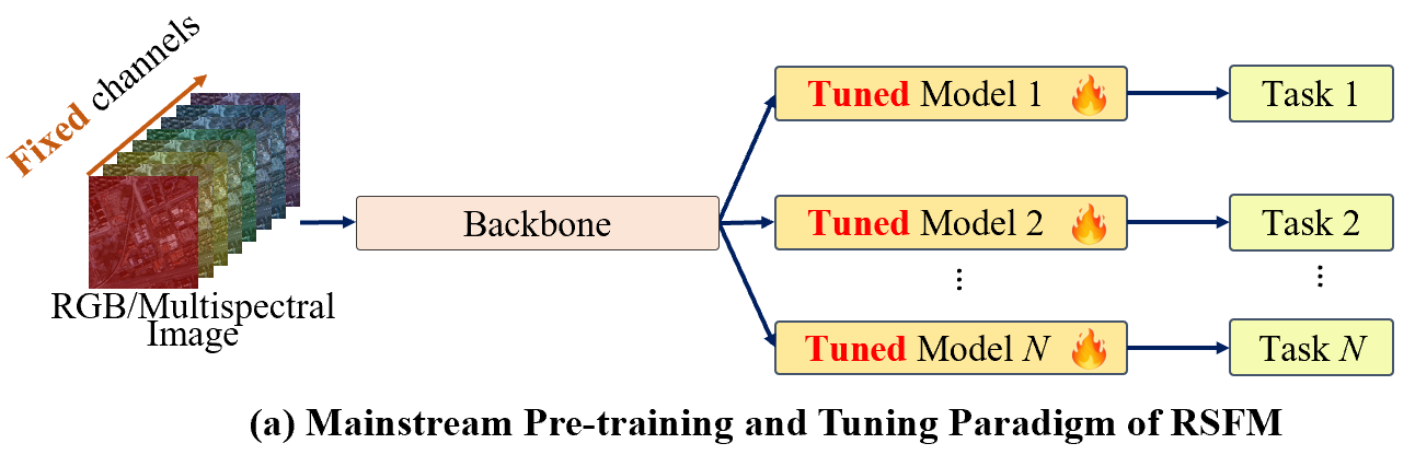
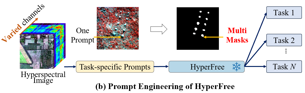
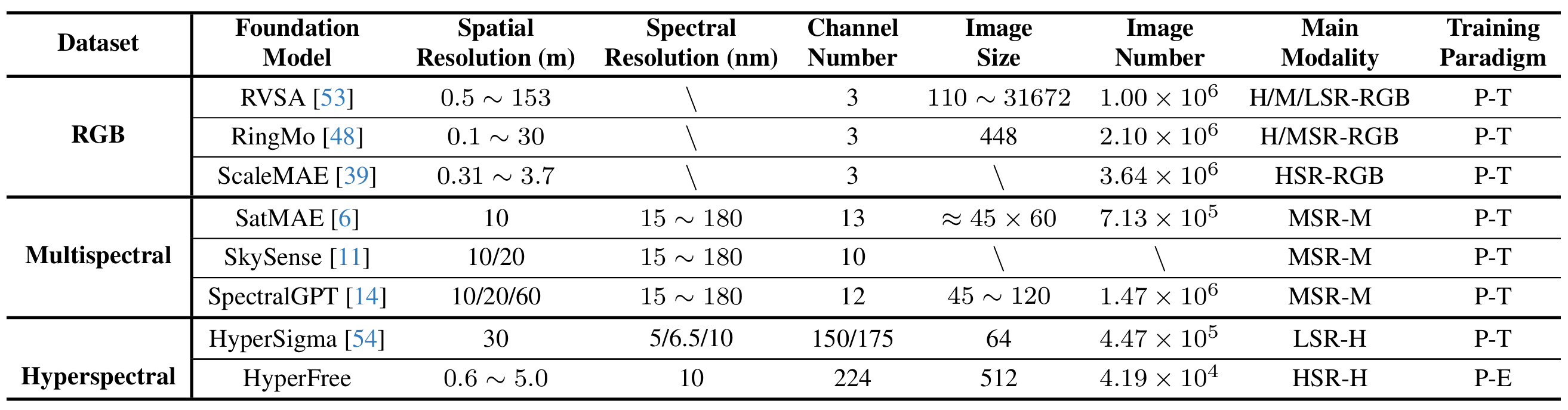
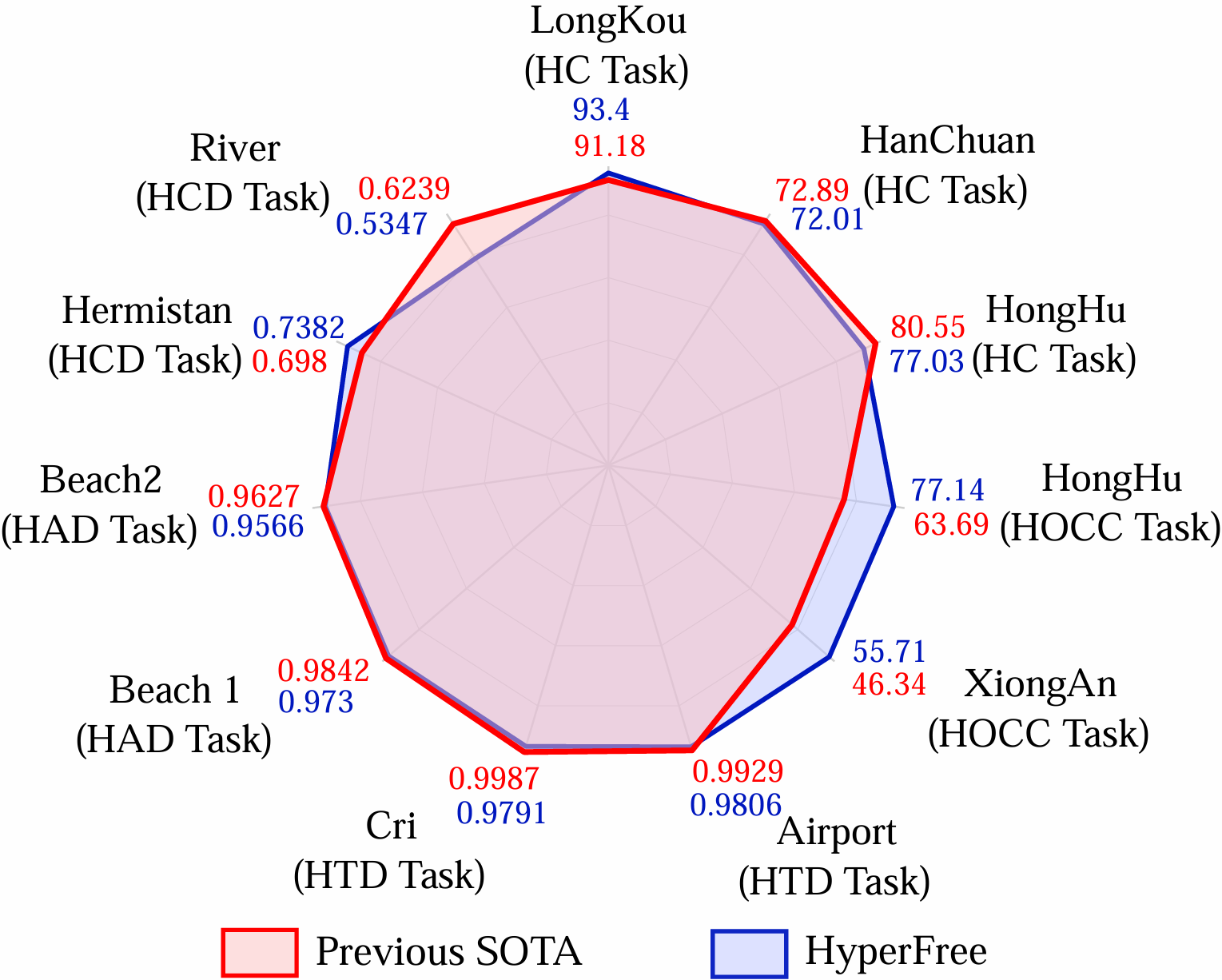
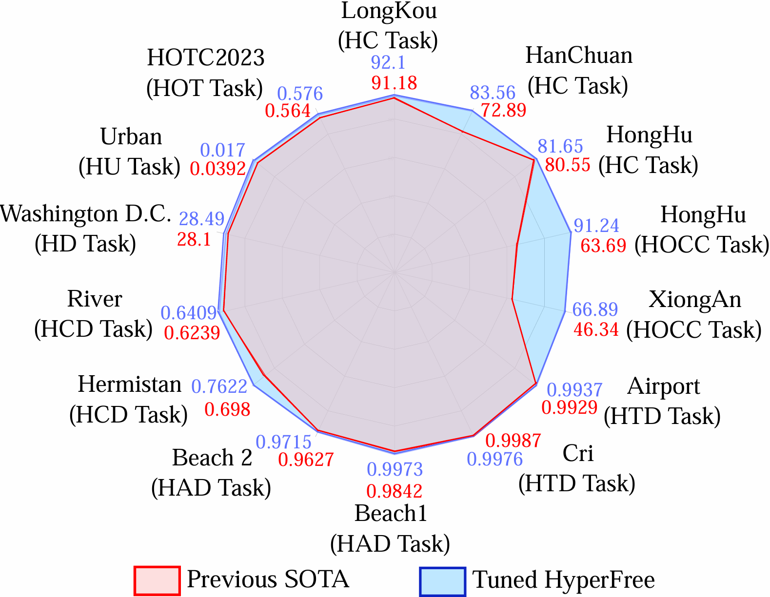
Advanced interpretation of hyperspectral remote sensing images benefits many precise Earth observation tasks. Recently, visual foundation models have promoted the remote sensing interpretation but concentrating on RGB and multispectral images. Due to the varied hyperspectral channels, existing foundation models cannot process new sensor types directly and face image-by-image tuning situation, imposing great pressure on hardware and time resources.

Uniqueness of HyperFree

Existing remote sensing foundation models (RSFM) would face image-by-image tuning situation, imposing great pressure on hardware and time resources. In constrasy, HyperFree can process any unseen hyperspectral image directly without tuning in five tasks.

HyperSeg Data Engine

Hyper-Seg is built to generate segmented masks automatically for large-scale promptable training. We finally obtained 41900 high-resolution image pairs with size of 512×512×224.

HyperFree accepts varied image channels

To process varied channel numbers, we design a learned weight dictionary covering full-spectrum from 0.4~2.5 μm, supporting to build the embedding layer dynamically.

Zero-shot manner of HyperFree

HyperFree can complete anomaly detection and change detection in zero-shot manner.

Promptable manner of HyperFree

HyperFree can complete multi-class classification, one-class classification and target detection in promptable manner.

Overall Results

HyperFree achieves comparable accuracy to state-of-the-art models in a tuning-free manner (using just one prompt), and outperforms most models after tuning.

Our Team

RSIDEA is an academic research group formed by researchers engaged in the research of remote sensing. The academic guidance is Professor Zhang Liangpei, and the person in charge is Professor Zhong Yanfei. "RSIDEA" means "intelligent data extraction, analysis and applications of remote sensing". The main research directions of RSIDEA are: hyperspectral remote sensing information processing, high-resolution remote sensing image understanding and geoscience interpretation of multi-source remote sensing data.

Wang Xinyu

wangxinyu@whu.edu.cn
Associate Professor

Zhong Yanfei

zhongyanfei@whu.edu.cn
Professor

Li Jingtao

jingtaoli@whu.edu.cn
PhD Student

Liu Yingyi

2020302131039@whu.edu.cn
Graduate Student

Peng Yunning

Graduate Student

Wang Shaoyu

PhD

Jiang Xiao

Graduate Student

Sun Chen

PhD Student

Sun Zhendong

PhD Student

Ke Tian

PhD Student

Lu Tangwei

Graduate Student

Zhao Anran

Graduate Student